With the continuous advancement of global technology, the application scenarios of aerial robots are rapidly expanding. Aerial robots have demonstrated their unique advantages across a wide range of fields, including aerial photography, agricultural plant protection, public security, power line inspection, surveying and mapping, disaster relief, logistics and transportation, water resource management, land surveying and monitoring, geological exploration, and wildlife conservation. Thanks to their flexibility, high mobility, efficiency, and operational safety, aerial robots are gradually transforming the way traditional industries operate — enhancing work efficiency while ensuring personnel safety.
1. Agriculture and Forestry

1). Precision crop protection and diseased wood transportation
By leveraging multispectral sensors and intelligent spraying systems, aerial robots enable precision pesticide application and real-time crop health monitoring. In 2024, BRICS agricultural aerial robots in China have conducted over 2.6 million kilometers of farmland inspections, achieving an operational efficiency more than 40 times higher than traditional manual labor, while significantly reducing pesticide pollution and the risk of human poisoning.
In suburban counties around Beijing, agricultural aerial robots with a payload capacity of 75 to 100 kilograms have been deployed to transport pine wood infected by pine wilt disease. These robots can transport 7 to 10 tons of infected wood per day, overcoming the terrain limitations of traditional manual handling methods.
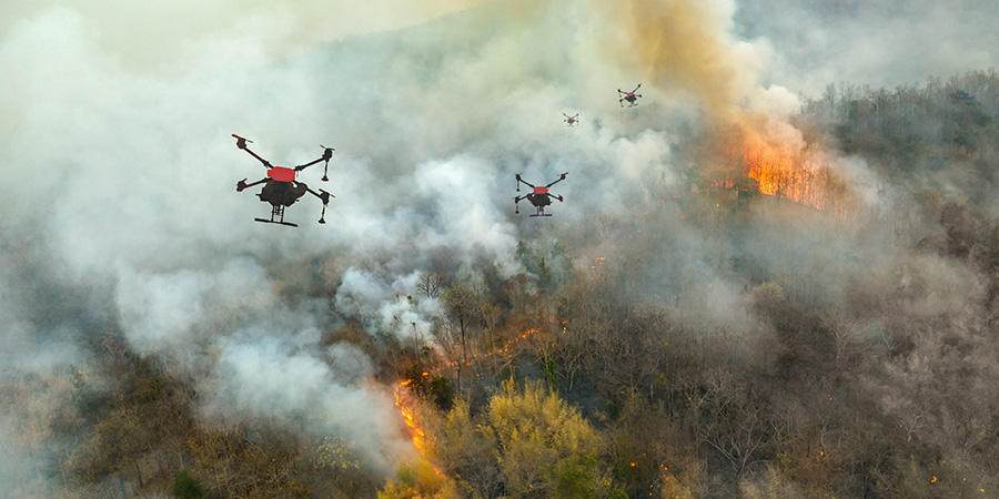
2). Forest Fire Prevention and Ecological Protection
Equipped with infrared thermal imaging technology, aerial robots can rapidly locate fire sources and transmit real-time fire data to command centers. In Dongguan County, Guangdong Province, the local fire department has established a "3-minute reconnaissance zone" using aerial robot stations (drone airports), improving disaster response speed by 70%.
In addition, aerial robots are also applied in wildlife monitoring. By using infrared cameras to track poaching activities, these robots play a vital role in protecting the habitats of endangered species.
2. Logistics and Urban Delivery

1). Efficient Delivery and Cost Optimization
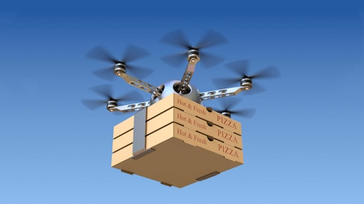
Aerial robot logistics have demonstrated significant advantages in both remote mountainous regions and urban environments. In the mountainous areas of Sichuan Province, SF Express utilizes aerial robots to transport agricultural products, reducing delivery time from 7 hours to just 1.5 hours.
In urban pilot programs, aerial robots have also been deployed for pharmaceutical delivery, achieving a delivery cost of only 0.8 RMB (Chinese Yuan) per kilometer — compared to 3.5 RMB (Chinese Yuan) per kilometer for traditional vehicles — and completing a one-kilometer delivery in as little as 40 seconds.)
2). Low-altitude Logistics Network Construction
Unmanned airports (3) support vehicle-mounted mobile deployment, enabling highway inspections and logistics transshipment. There are plans to deploy more than 10 aerial robot takeoff and landing points in Zhejiang, aiming to build a large-scale low-altitude logistics network. In tourist attractions, aerial robots control food delivery time within 10 minutes, becoming a new benchmark for smart cities.
3. Public Safety and Emergency Rescue

1). Firefighting and Disaster Response
Urban firefighting has developed an "aerial firefighting" system, with aerial robots equipped with toxic gas detectors and window-breaking tools, enabling 3D modeling of fire scenes and high-altitude fire extinguishing. The aerial robot station can reach the scene within 3 minutes, transmitting real-time images to assist in rescue decision-making. Over 120 operations have been carried out to date.
2). Police Patrols and Disaster Rescue
Urban police utilize aerial robot stations to achieve full coverage of high-altitude patrols across the entire area, supporting traffic monitoring, evidence collection for violations, and counter-terrorism and stability maintenance. In disasters like earthquakes, aerial robots quickly deliver supplies and generate high-definition maps of affected areas, improving rescue efficiency.
4. Energy and Infrastructure Inspection

1). Power and Energy Facility Maintenance
Aerial robots have conducted power line inspections covering over 2.6 million kilometers of transmission lines, increasing inspection efficiency by 90% and enabling live-line operation without the need to shut down power.
In the Sulige Gas Field of Xinjiang Autonomous Region, the adoption of aerial robots has saved more than 10,000 labor hours annually while enabling the precise detection of overheating and other line defects.
2). Traffic and Water Infrastructure Monitoring
Aerial robots, combined with 3D laser scanning technology, create high-precision models of bridges and reservoirs, identifying structural risks in advance. In Zhejiang Province, aerial robots conduct regular river patrols, enabling flood early warning and monitoring of illegal wastewater discharge.
5. Environmental Protection and Resource Management

1). Ecological Monitoring and Pollution Control
Aerial robots equipped with multispectral sensors are used for water quality analysis, air pollution tracking, and illegal wastewater discharge evidence collection. For example, in the water conservancy industry, aerial robots monitor flood and waterlogging disasters, providing data support for emergency decision-making.
2). Land Resources and Geological Exploration
The aerial robot mapping market reached 15 billion yuan in 2023, with widespread applications in urban planning, mineral exploration, and underground pipeline inspection. Its low-altitude remote sensing technology can quickly obtain key data such as geological faults and groundwater distribution.
6. Smart Cities and Emerging Consumption

1).Municipal Management and Convenience Services
In urban areas, aerial robots enable "cloud inspection" for construction site supervision and environmental monitoring, reducing manual inspection time by 80%. New models such as aerial robot food delivery and material delivery in tourist attractions are rapidly being implemented, creating an integrated "air, land, and space" management system.
2). Film and Entertainment and Low-altitude Tourism
In 2024, the market size of aerial photography using aerial robots has reached 12 billion RMB (Chinese Yuan), providing unique perspectives for film production and sports events.
In urban settings, aerial robots have also been utilized to transport live, fresh fish, completing cold-chain delivery from offshore locations to hotels within 15 minutes. This innovative application is driving the integration of "low-altitude economy" with cultural tourism, opening up new possibilities for smart logistics and immersive travel experiences.
7. Future Trends and Technological Challenges

1).Intelligent and Scalable Development
The 5G-A communication network and AI algorithms are driving the autonomous flight capabilities of aerial robots. BRICS innovation and educational technology companies plan to open sensor interfaces, empowering developers to customize industry-specific solutions.
With the support of low-altitude economy policies, the Chinese aerial robot market is projected to exceed $100 billion by 2029, while the global market is expected to reach $167.6 billion.
2).Infrastructure and Policy Coordination
By 2028, China plans to establish the "Low-Altitude Three Networks" in urban areas, including the infrastructure network, air route network, and flight service network, to address airspace management and endurance challenges. Currently, technological obstacles such as high deployment costs and adaptability to harsh weather conditions must be overcome.
BRICS Innovation Education Technology Company, with its leading technology and deep industry expertise, is committed to bringing the BRICS brand drones to the global market, meeting the diverse needs of customers across procurement, application, and technical training. The company has established a one-stop service system that includes rigorous quality control, precise supply chain management, and customized training solutions, ensuring that customers receive professional, efficient, and reliable support throughout the entire lifecycle of drone applications.
We actively respond to international market trends, continuously promoting technological innovation and service upgrades, earning broad international recognition. We welcome global partners and potential buyers to engage in in-depth discussions regarding procurement, operational support, and training services, jointly exploring new possibilities for high-tech applications.
For detailed cooperation inquiries, please contact: yunhe@bricsedu.org.cn or bricstrade100@gmail.com.
Scan The Code To Add
Your Exclusive Consultant
